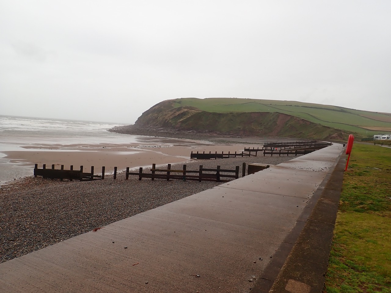
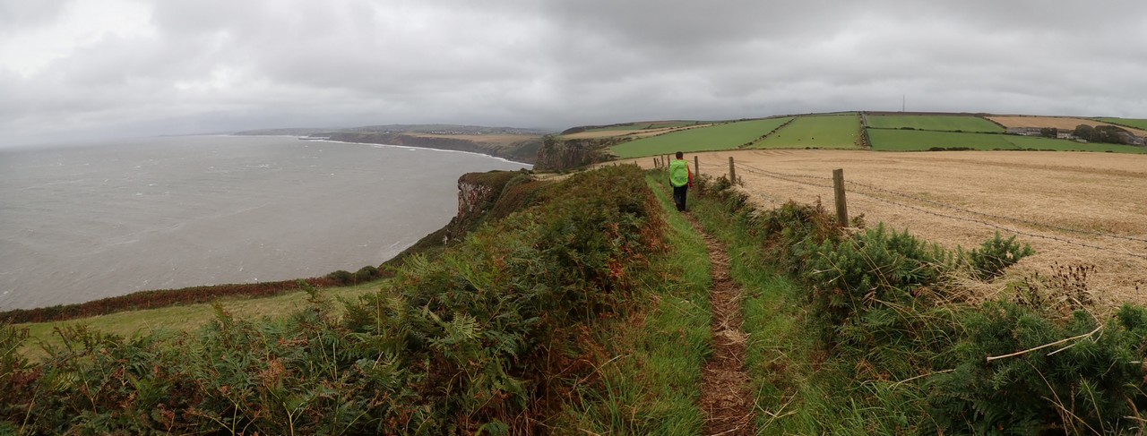
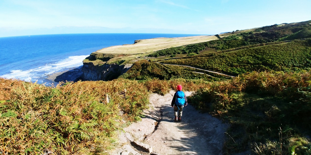
As we traverse across St Bee’s headland, 50+ mph wind gusts are making even standing upright a difficult proposition. Looking out upon the Irish Sea with waves pounding on the cliffs below, the accompanying rain being propelled by the relentless wind, feels like needles hitting your face. Mind you the cattle and sheep that were grazing atop the headland seemed relatively unperturbed with these conditions. Coming from Queensland, we could only imagine how one lives here through the winter northerlies.
Coming from the other side of the world to traverse the 305+ kms across England on the Coast to Coast Path does require some planning. Particularly if staying at B&B’s, pubs and guesthouses as we did, as leaving it to the last minute will leave your accommodation options very limited. Fortunately we had that well in hand (actually Elena organized all that) including the daily pick-up and drop-off of our luggage between each accommodation point.
Besides our excitement of taking on this adventure; I had never visited this part of the world before, so was very keen to experience the history, architecture and general rural English way of life. I also had another plan that was consuming my thoughts, one that I had not shared with Elena, but all going well would unfold in the coming days.
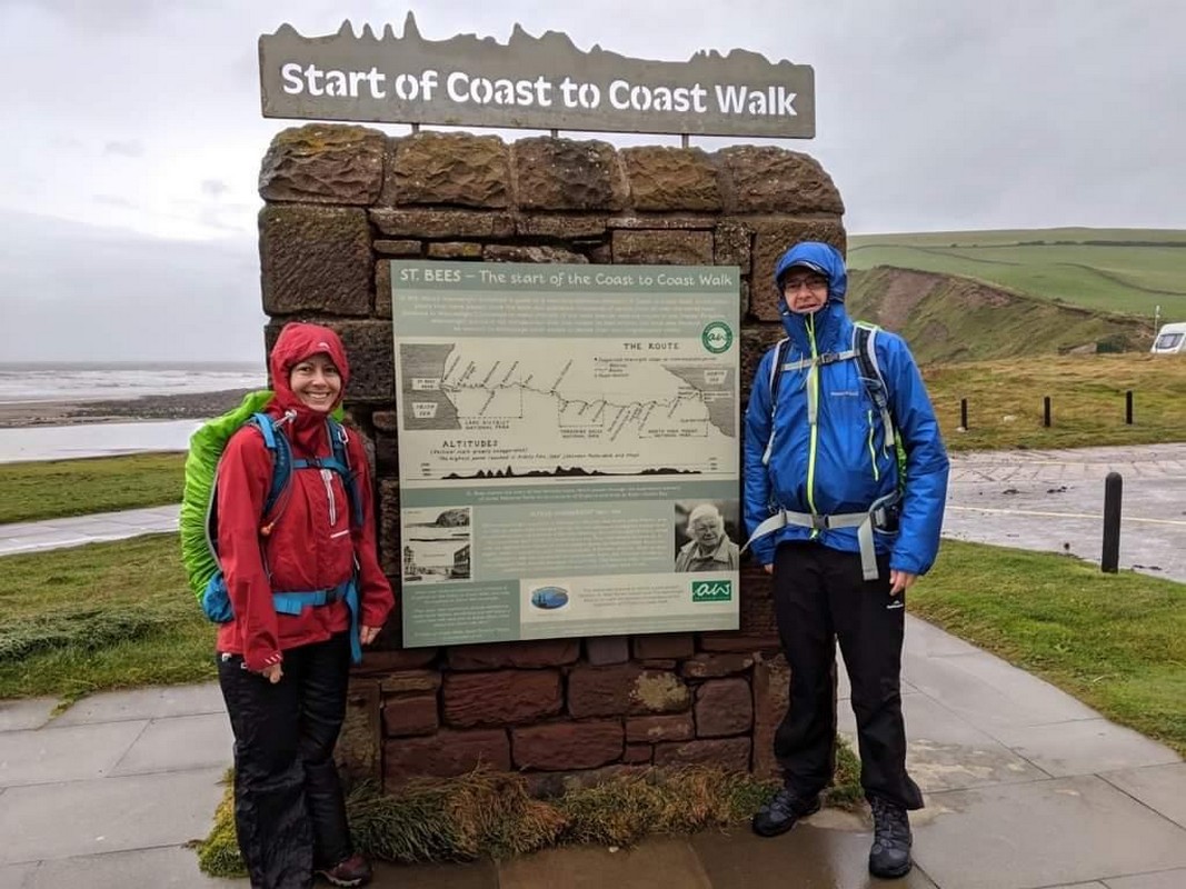
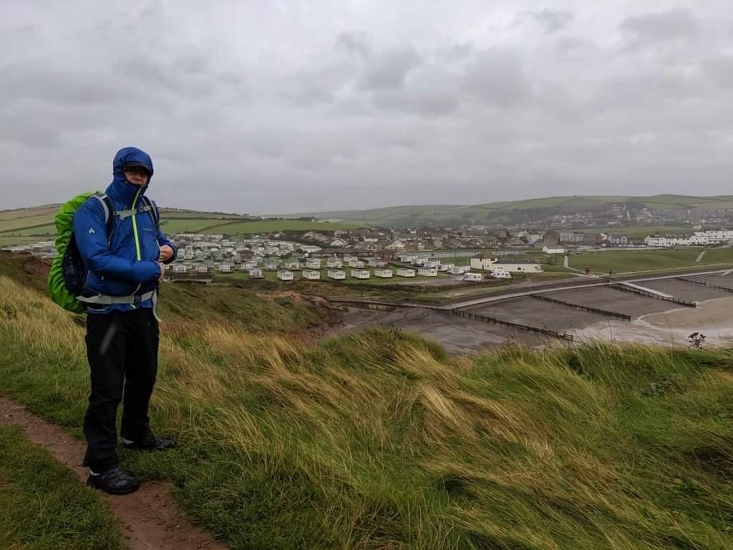
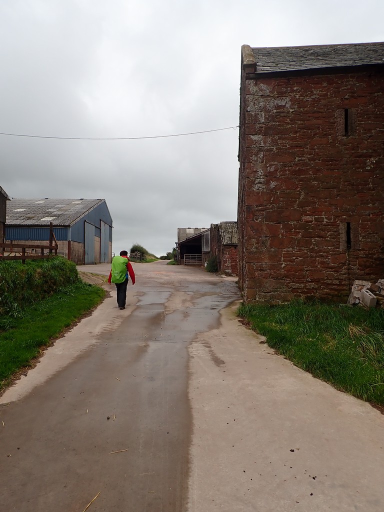
Day 1 – Leaving the exposed headlands of St Bees – of which the views were superb despite the weather – we headed inland where mercifully the wind eased and the sun dominated. Not a difficult day, but still a good introduction to what lay ahead, arriving late afternoon at the pub in Ennerdale Bridge for what would become a common daily ritual of a cold beer.
…………..
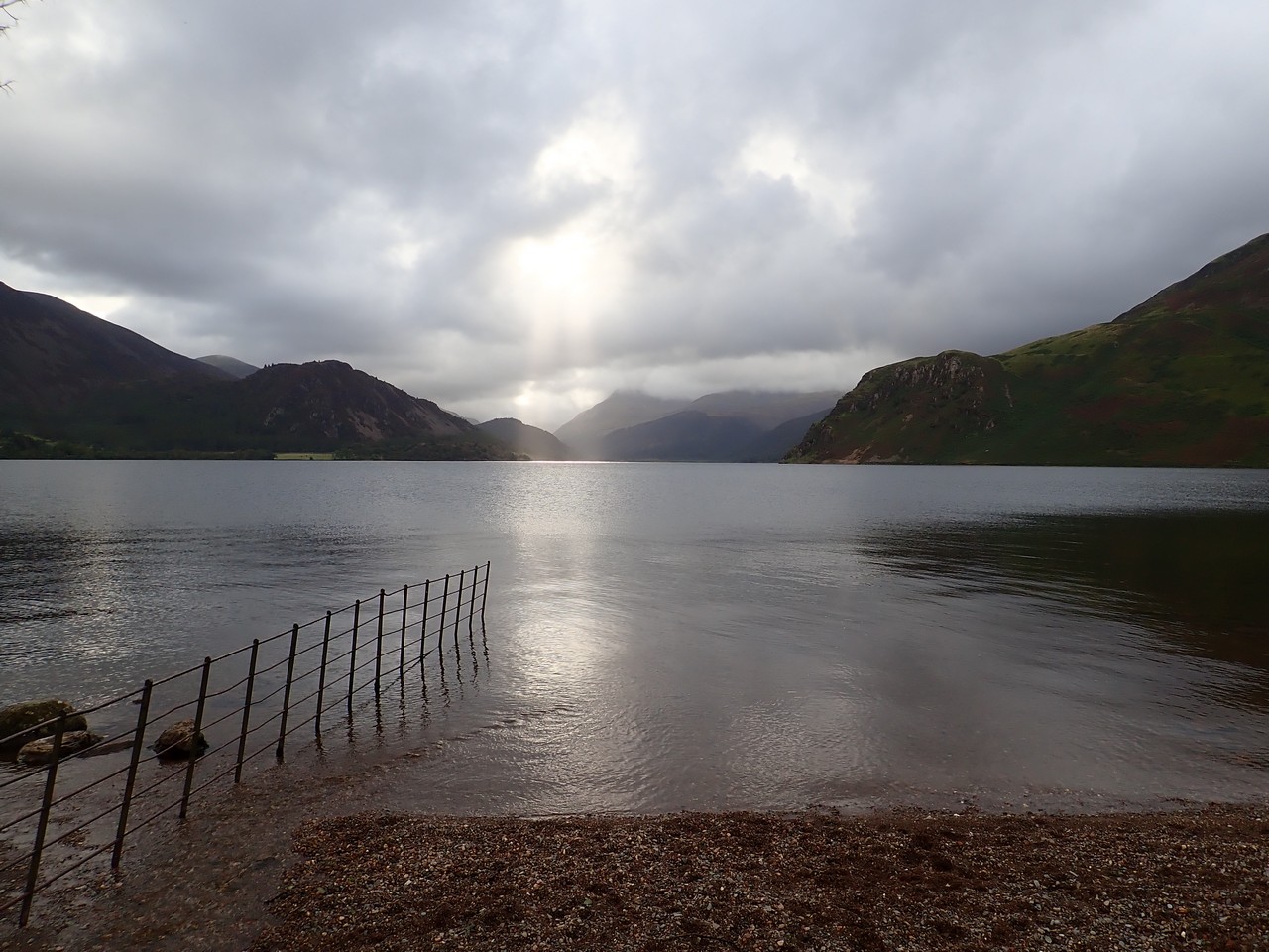
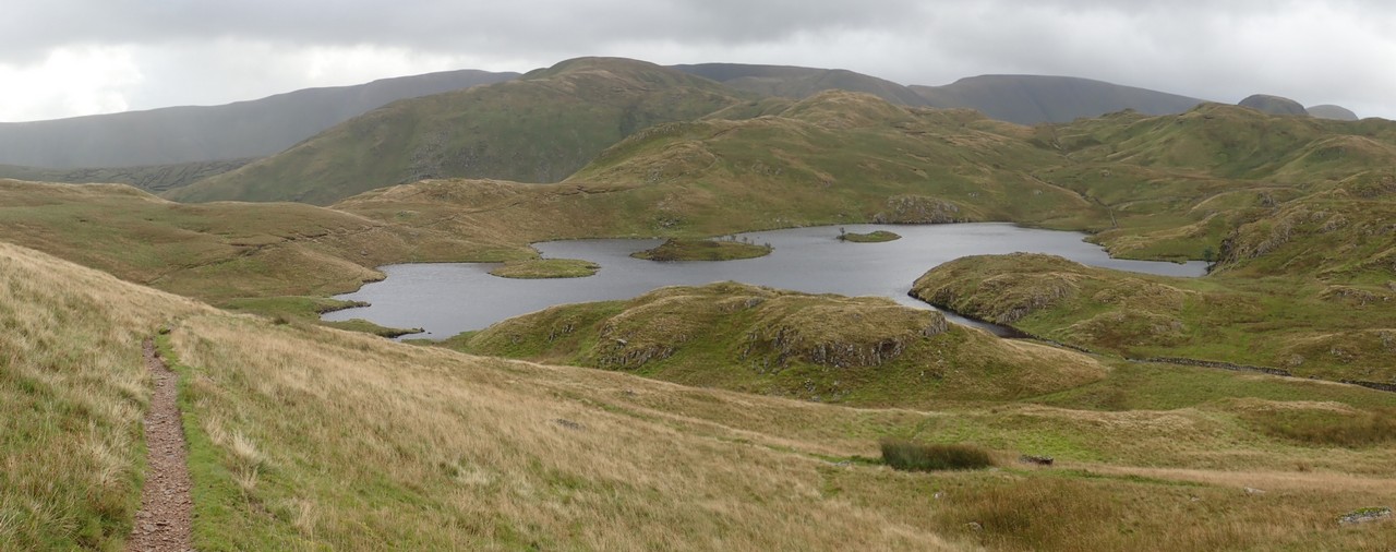
Day 2 – It’s only a short walk to the waters edge of the lake known as Ennerdale Water. Due to recent rainfall, we take the local’s advice to skirt the northern edge, which was an easy yet interesting walk as we interacted with nearby residents out walking their dogs. We discover later that evening, the Southern Edge of the lake was indeed slow going with plenty of mud, and were grateful for the choice we made.
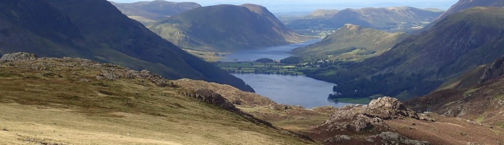
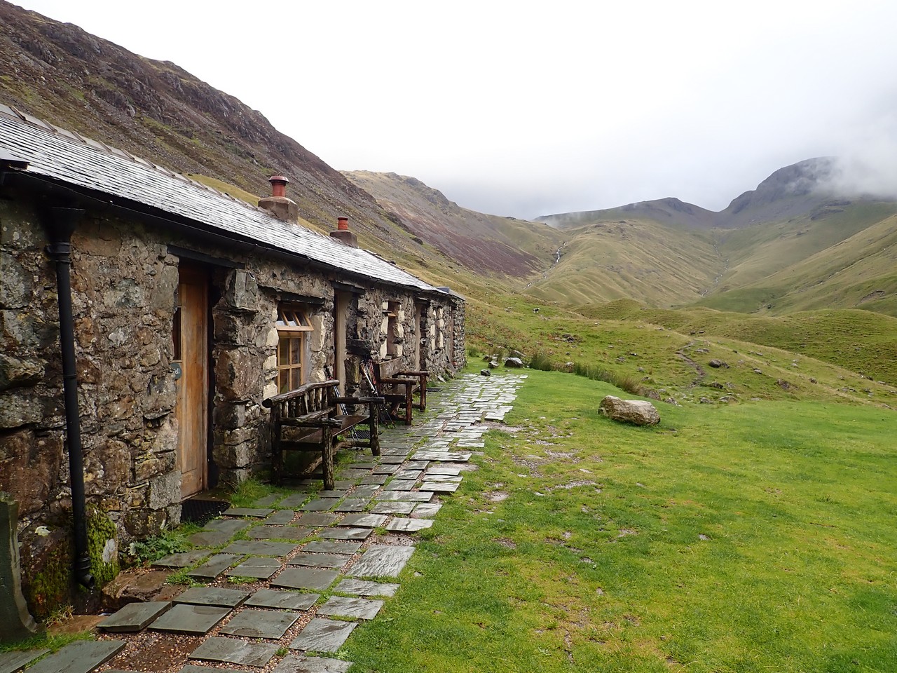
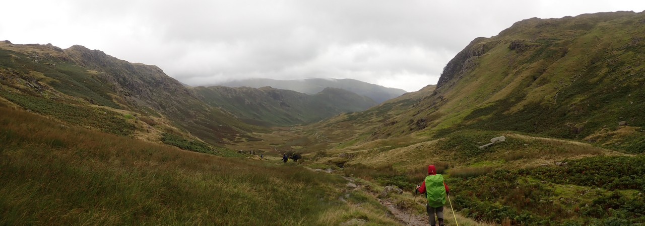
After passing the lake, the walk along the dirt road adjacent to the river, to the far end of the valley is somewhat mundane. However that soon changes upon reaching the ideally located – but very remote – Blacksail YHA, nestled at the end of the valley. The YHA is ringed steeply by high crags on three sides, and it’s clear the path from here can only go up, and is the first of our steep climbs in the Lake District.
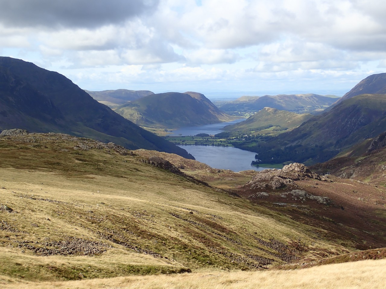
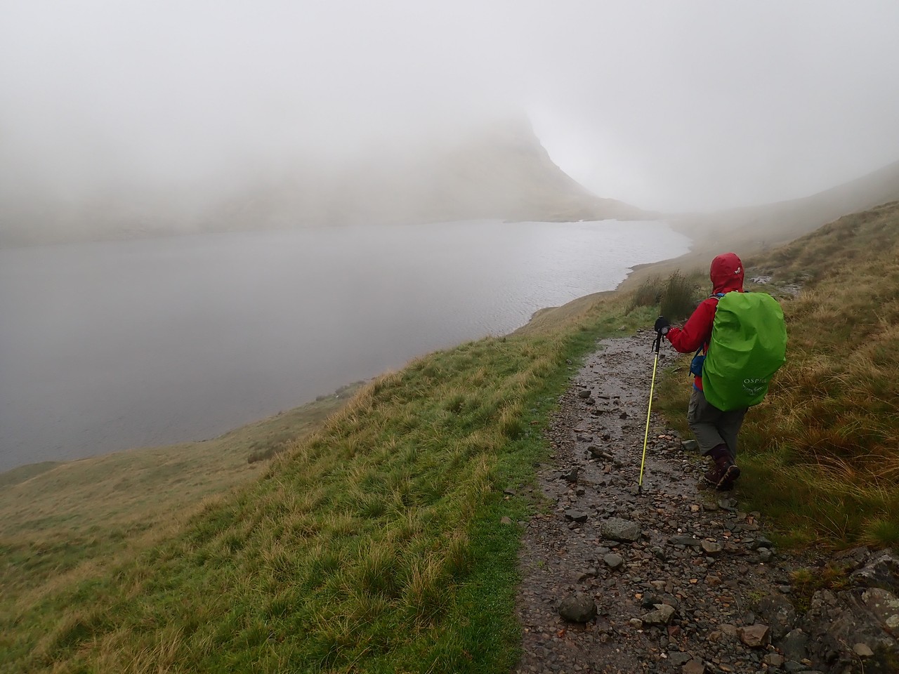
On reaching the high saddle – and our first initiation with the famous English bog – we are rewarded with insane views particularly of Buttermere and beyond. After reveling in our vista of Northern England, the trail soon descends steeply down to the Honister slate mine complete with visitor centre and cafe.
What was largely a perfect day for walking, ends with a short stroll through a beautiful forested walk adjacent to the river and some farms, before entering the village of Rosthwaite. We also discover that evening, that had we been setting a faster pace, we would have walked through a hailstorm atop the saddle, our second good call for the day!
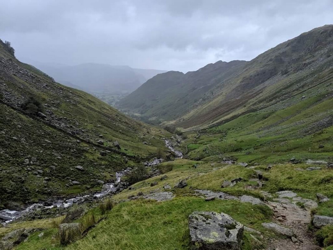
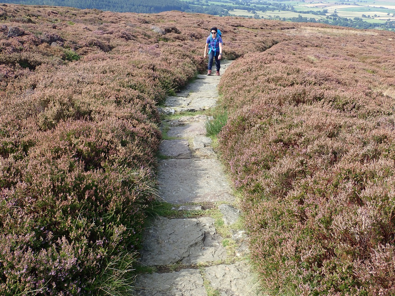
Day 3 – Our walk today started with rain, ended with rain, and I swear it rained for every single minute in between! Yes it eased from time to time, but cease it did not. A day with plenty of Englands ‘bog’ paths and a day when the stony paths that form the trail literally became running streams. The spectacular views of the day prior were nowhere to be seen due to the low cloud and fog, and pausing for any length of time, particularly on the wind exposed high points, resulted in the biting cold quickly setting in.
The fields here in England – or ‘paddocks’ as we refer to them in Australia – are separated by these amazing stone walls, the number of which and size of some, are on a scale you can’t imagine. The man hours spent constructing them would be mind boggling, given the height and thickness of some we encountered, it would surely have been a good day’s work just to construct a couple of metres. And that’s on flat ground, to then see some heading up incredibly steep hillsides only adds further to the awe of those who built them, with some no doubt going back hundreds of years.

My knee is giving me awful grief today as I hobble into the pretty village of Grassmere and not the day that I wanted to see that our accomodation is on the opposite of town. Grassmere reminds us of Montville in Queensland’s Sunshine Coast, with plenty for visitors to see and do with Museums, outdoor shops, bookshops, cafes and the nearby lake. Would definitely recommend Grassmere as a great rest day location.
Once we were finally showered, dry and warm, there was no desire to walk back into town for dinner in the still falling rain, so we attacked our rations instead.
Day 4 – The long slow climb to Grisedale Tarn starts immediately from the town edge. Whilst it’s not raining, the clouds are ominous and eventually deliver rain, however not on the scale of the day before.
The trail through the Lake District involves a lot of ascent or descent, with moments of easy walking on level terrain being few and far between. However for those seeking an even greater challenge in the Lake District, the trail offers several ‘high route options’, rewarding those who take this option with the promise of even more spectacular views. Unfortunately the gusting winds and cold rain, along with low cloud obscuring the ‘reward’, are making the high route options somewhat pointless.
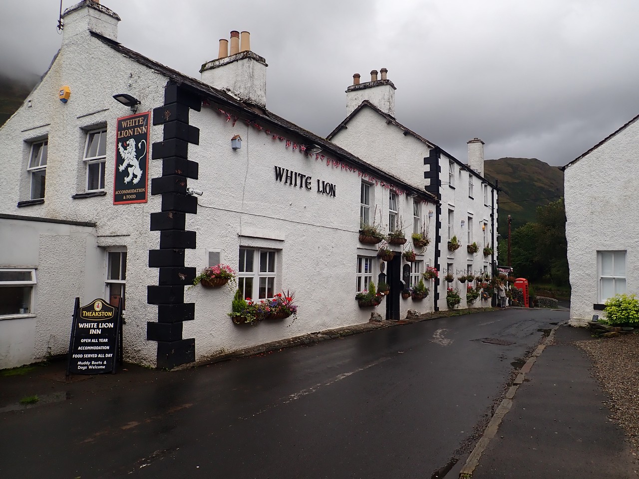
The descent to Patterdale is long, but gentle and picturesque, and much easier on the knees. The small village of Patterdale has two pubs, and the White Lion would rate as one of our favourites on the entire trail….a place you could happily spend the day.
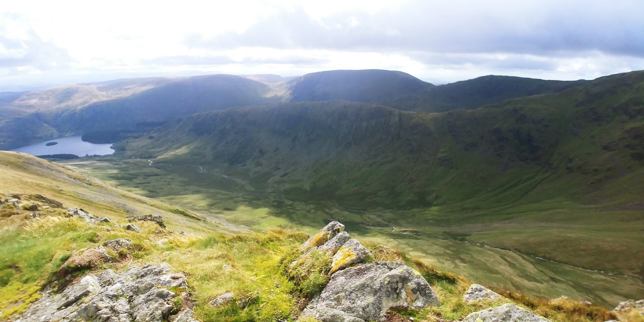
Day 5 – Looking out the window this morning, we are heartened to see some clear sky. Today of all days, rain will be an unwelcome companion. Being arguably the hardest day on the C2C, it combines a 600m+ climb to the highest point on the C2C (Kidsty Pike) and also 25 klm in distance. Unfortunately I will have to complete today’s walk on my own, with Elena not feeling well and taking the bus to tonight’s accommodation. Unfortunately this will mean one of the plans I had whilst standing atop Kidsty Pike, and to finally reveal to Elena what has been consuming my thoughts, will have to wait for another ‘right’ moment.
The clear views in all directions accompanied by sighting of deer makes this day one of the walks highlights and well worthy of the effort. The breathtaking views are a fitting exit to the Lake District. Sadly 50mph+ winds limit my stay at Kidsty Pike, before the knee busting descent to the shores of Hawes Water Reservoir. It’s here the rain returned and shadowed me for the majority of the remaining 16 klms to the township of Shap.
The ruins of Shap Abbey located several hundred metres out of town and founded in 1199, is a reminder of the incredible history that can be found here. The township of Shap couldn’t have come soon enough, as I walk (stumble) down the long main street in the rain to our accommodation and much anticipated hot shower and meal.
Day 6 – After the previous days marathon, Elena has mercifully included a shorter walk in todays itinerary and as we are now out of the Lake District, the undulation is also considerably less as we traverse across the Westmoreland Plateau. Surrounded by fields of sheep (England has lot more sheep than I ever imagined) the path intersects several very ancient sites, going as far back as the Romans. Its quite surreal to see these relicts, as I imagine a battalion of Roman troops marching past two by two wearing the metal armor on this very same path. We also pass Robin Hood’s grave (the real Robin Hood?).

A short stop in the small village of Orton and the delightful chocolate factory (including a cafe) is a very rare treat and very difficult to leave. Then a short walk onto our farm B&B at Raisebeck. This was one of the many brilliant B&B’s we came across – the owner even drove us back to Orton so we could have a pub meal and returned to pick us up when we were ready to leave. Today was also our first day without any rain!
Day 7 – Today was very similar to the previous day and again without any precipitation (if you don’t count the downpour mid morning which we waited out before starting). Whilst largely an uneventful day as we continued across the Westmoreland Plateau and Yorkshire dales National Park – the history lessons continued including archeological digs and sites of ancient settlements.
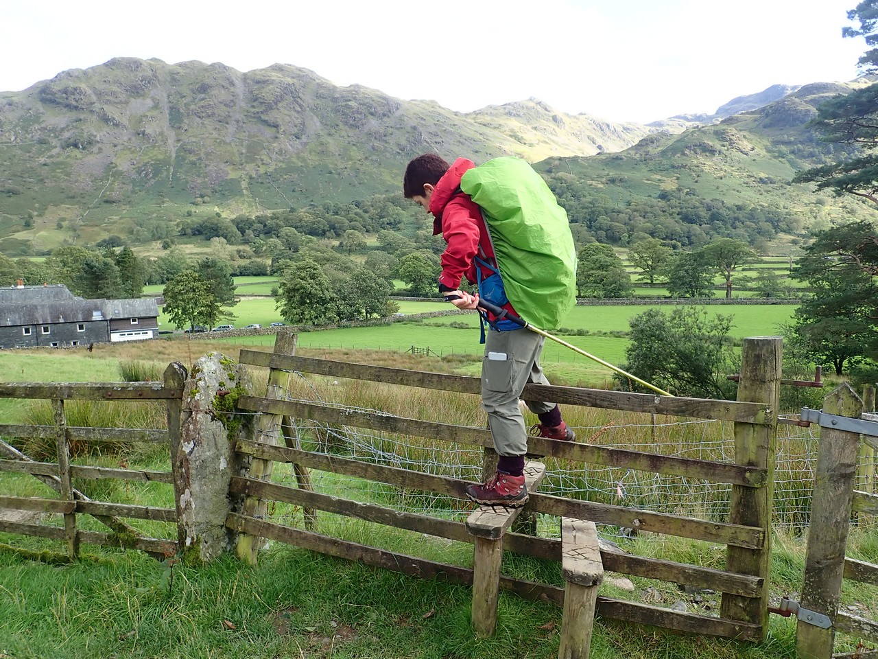
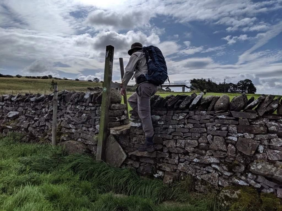
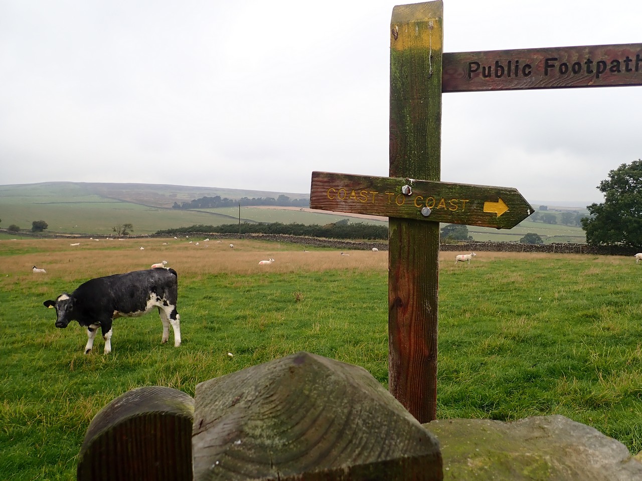
One aspect of the walk I was not anticipating and to some degree is quite confronting – or at the very least uncomfortable. This being that the C2C follows very old trails or ‘foothpaths’ as they refer to them here, which on many occasions will have you traversing across a farm including walking through grazing livestock. In fact in some instances, even between the barns and buildings. Crossing property boundaries is also done via ‘stiles’, of which there must be at least a hundred on the entire C2C (or seems like it).
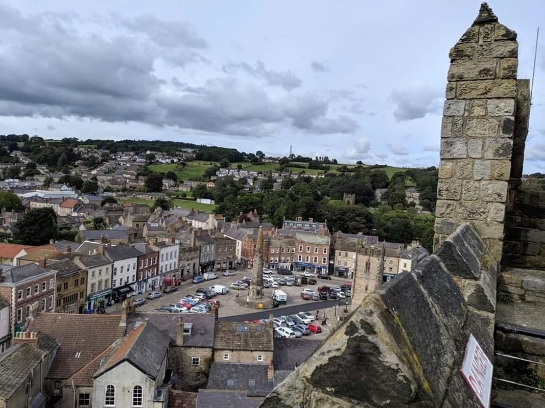
We arrive late afternoon at Kirkby Stephen and being the largest town thus far on the walk, the traffic gives a little jolt to the senses. Here we meet Mark and Sarah from London who will join us for the next three days through to Richmond – and so my ‘plan’ for Elena will have to be put on hold again – starting to wish I had taken action earlier in the walk – will there ever be the right moment!
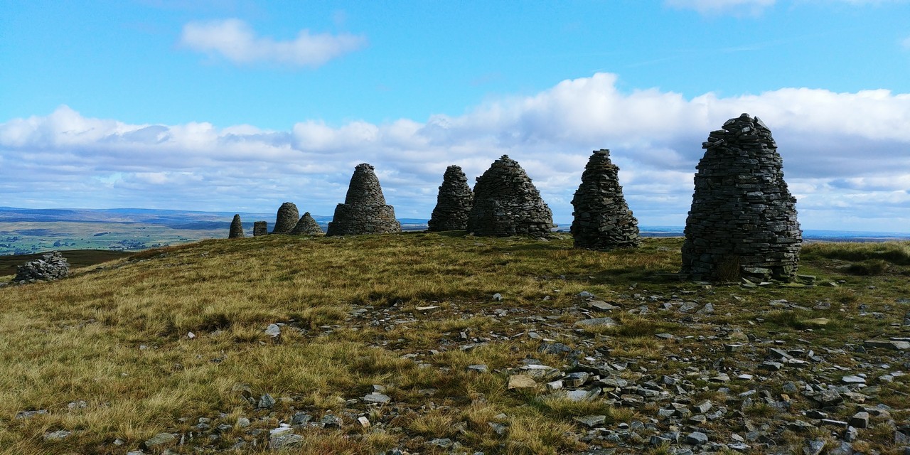
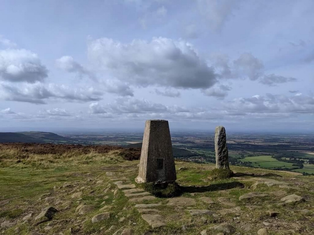
Day 8 – Today is 21 km and begins immediately out of town with a long gradual climb to the intriguing Nine Standards Rigg. Said to be built by the Romans to resemble an army, these nine rock pillars have an incredible outlook over the surrounding landscape as are the 360 degree views from the nearby trig point. This also marks the east/west watershed for this part of England – downhill now all the way to the North Sea?
Whilst we have already had some bog experience, soon after leaving the Nine Standards Rigg begins what is likely the longest section of peat bogs on the C2C. Thankfully a new stone footpath had just been installed through the worst section, however beyond this required a deal of effort and navigation to negotiate through the worst sections without disappearing into the muddy abyss.
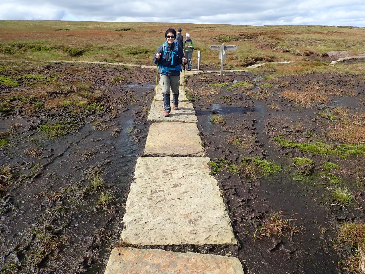
Eventually firm ground is found as we descend down to the meandering Whitsundale Beck, which no doubt has offered many walkers the opportunity to wash copious amounts of mud from themselves. The weather today was near perfect, so would hate to think how difficult it would be getting through those peat bogs on a wet day!
A long day is made even longer with a diversion to tonight’s overnight stay at the amazing Frith Lodge atop a high ridge with fantastic views back along the valley to Keld. Watching working sheep dogs in action was a highlight and the lodge itself is surrounded by rabbits and pheasants.
Day 9 – Leaving Frith Lodge (well worth the stay – if not just for the location let alone the excellent food), it’s a beautiful morning walking back to Keld and the C2C path, passing on the way a local who greets us with a “How do!”
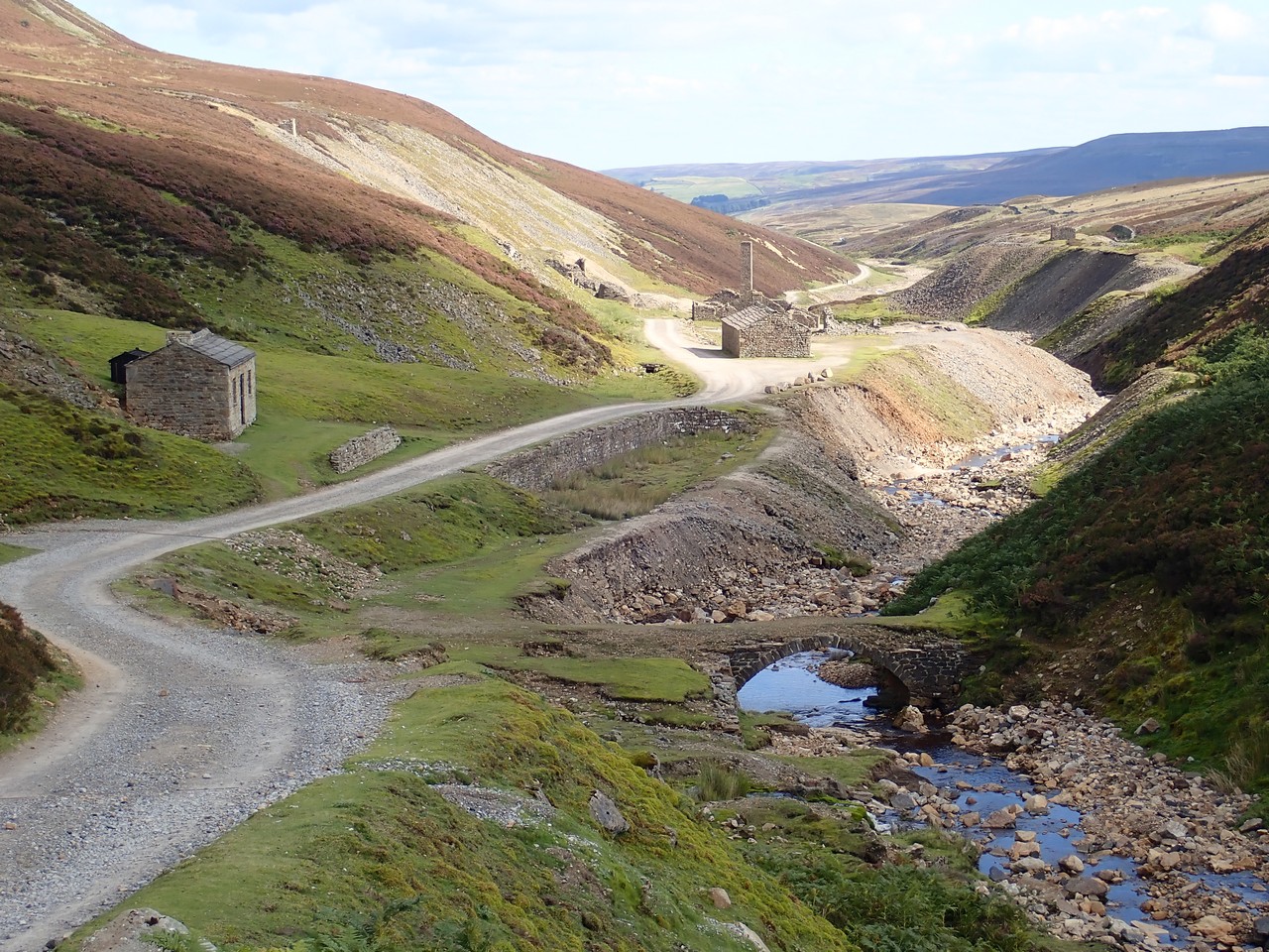
Taking the high route to Reeth, whilst less visually appealing, was somewhat of a history lesson in the mining activities that occurred here, which appear to have been predominately lead mining. Evidence everywhere not only of the mine sites, but also ruins of old buildings going back centuries. In fact it’s believed lead mining here dates back to Roman times, however increased with the commencement of the Industrial Revolution in the 17th century.
As we enter the small town of Reeth, the impact of flooding which occurred only in recent weeks is very evident, with several buildings now unable to occupied and some stone walls noticeably damaged.
Yet another great day of weather – Mark and Sarah are getting spoiled!
Day 10/11 – Today was a relaxing walk through fields and farms, past grazing cattle, quiet roads and at times adjacent to a fast flowing river. The rain did return for the odd appearance and it was during one of these wet occasions, that we stumbled upon Elaine’s kitchen. Operating out of the farmhouse kitchen, her offerings of hot chocolate and tasty treats, desserts etc were very welcomed.
Walking into Richmond late afternoon, we arrive wet, cold and keen to find our BnB accommodation, which we now discover is a short walk out of town. A phone call to the owner who quickly arrived and took us back to his brilliant house which has been converted from a centuries old barn – and easily our best breakfast on the entire walk.
Richmond is the largest town on the walk and a highly recommended place for a well earned rest day (which we did). Richmond offers plenty for the curious visitor including the nearby ruins of Easby Abbey and great restaurants, we even found a gin bar. However one can’t go past a visit to the Richmond Castle, located virtually in the centre of town. Richmond Castle boasts an incredible history and equally impressive views of the town and my first ever visit to a castle!

Interesting fact – of all the towns around the world named Richmond (of which there are four in Australia), this was the first.
Day 12 – 22 klms and the flattest terrain and possibly best weather thus far with sunshine and only light winds; and given today was my birthday, would expect nothing less.
The day began with walking alongside the River Swale, however other than a nervous walk through a herd of cows with calves, and a horse that accompanied us as we crossed the field in which it was kept, it was largely an uneventful day.
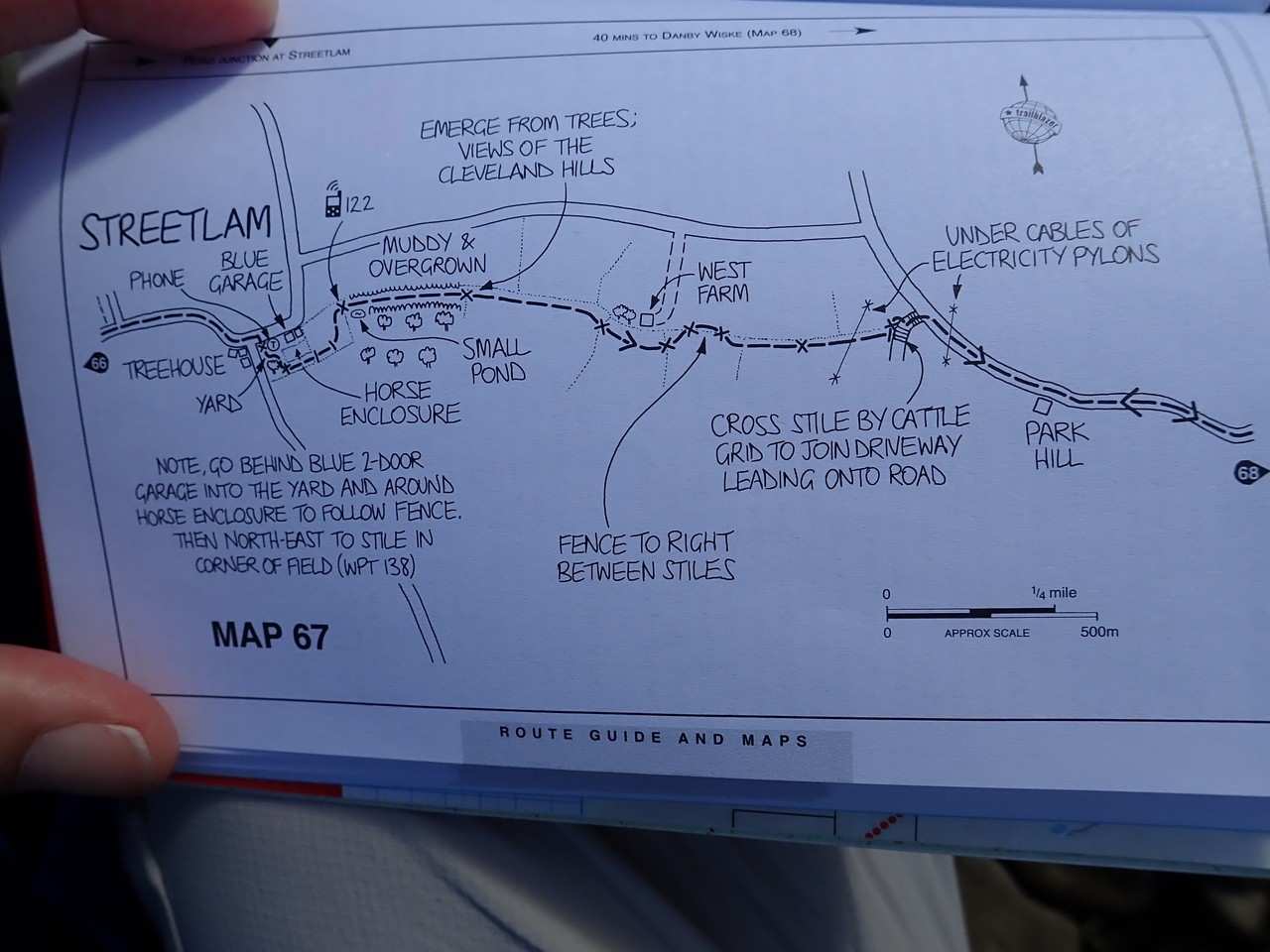
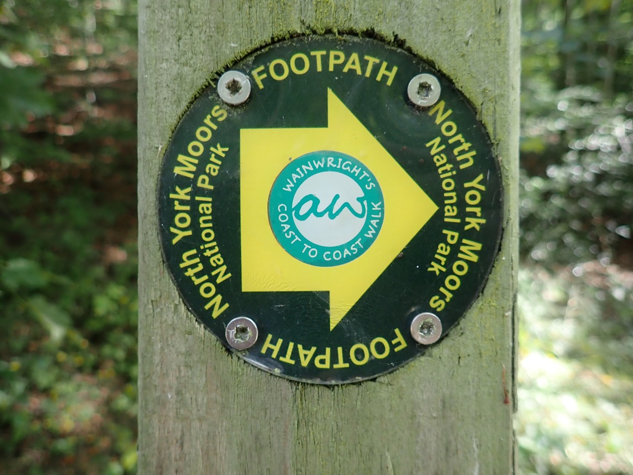
The C2C trail is a combination of paths, roads and tracks that is for the most part signposted, however any ‘signs’ can be few and far between, obscured or simply disappear. A compass and map provides some assistance, however a guide book not only gave us an insight into the history, geography etc of where we were, but also 90+ hand-drawn maps containing great detail and certainly reduced the number of times we were ‘lost’.
Our stay that night was in the village of Danby Wiske. There was only one pub in town and it continued the seemingly English tradition of being named after an animal, unfortunately it lacked the typical English pub history and ambience we were becoming accustomed. The “White Swan” with it’s publican behind the bar lacking any personality, was saved only by the kitchen cook and her excellent cooking skills.
Day 13 – Before leaving town, it’s well worth a visit to the local church dating back nearly 1000 years and several gravestones dating back to the 1700’s. I’ve noted the gravestones in all the old churches we have visited, are in the grounds immediately surrounding the church itself, rather than a nearby cemetery as we would see in Australia. Although presumably this is the case now in England also.
Like the day prior, the trail again follows roads and winds between and across fields with corn, soyabean, wheat stubble etc. Unfortunately farmers in the district have chosen this time of year to ‘fertilize’ their fields with animal or human sewerage that has a smell that is on a level that cannot be comprehended, particularly with the wind blowing in the ‘wrong’ direction. However a mid afternoon stop at a coffee shop/cafe provided sufficient recompense.
I’m not sure how many photo’s Elena has taken of cows as we walk through the farm fields, but I’m confident it would be a C2C record.

Late afternoon we divert to the beautiful village of Osmotherley, and what the “White Lion” hotel lacked the previous day, the “Golden Lion” pub (yes another animal name – honestly they all are!) easily made amends with charisma, ambience and atmosphere in spades.
One of the observations we’ve made here in England, particularly in pubs is the welcome attitude to dogs, be it in the bars or even dining areas. It’s quite a contrast to back home where they would be chased out immediately. Tonight we counted 3 waiting patiently under the bar while their respective owners stood adjacent sharing a beer and laugh, with another 2 sitting quietly under tables in the dining area.
Day 14 – Today was definitely one of our favourite days – not just the weather, with abundant sun and little wind, but also the walk itself.
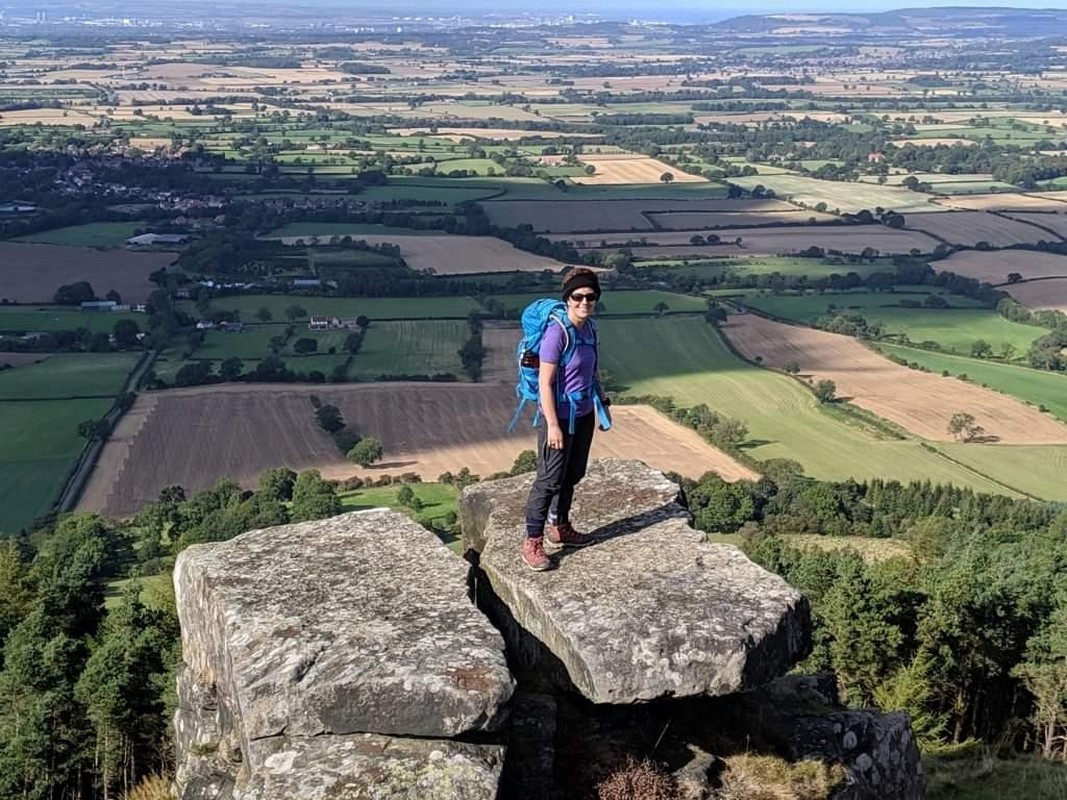
As you enter the North York Moors NP, you are immediately aware of the dominant living species here, with the Moors seemingly covered in its knee high carpet of flowering heather, and barely a tree in sight. To make a great day even better, the majority of the path is paved with stones ensuring no incursions with the mud and bog free walking. There was even a very good cafe adjacent to a road traversing the Moor – feeling very spoilt.
From the highest point from atop Carlton Moor, we observed and spoke with paragliders taking advantage of the days thermals. And a little further on, all but stumbled into a small group of people with their dogs shooting grouse, we were surprised to see them so close to a well frequented walking path.
Whilst the day did entail five short but steepish climbs and descents, the spectacular views north across the fields and the towns and farmlands below, adequately compensated and included also our 1st glimpse of the North Sea. Overall a day to savour. It was at one of these vantage points that considered again my ‘plan’ – I was running out of time – was this my opportunity, my moment to grasp?!
With no accommodation on the Moors itself, our BnB host picked us up from a pre-arranged point and delivered us to his nearby farmhouse, before taking all his guests to the local pub for dinner. At the age of 70, he does this every night, waiting in the public bar of the pub with his mates until his guests are ready to return home – I hope I have the same energy at that age.
Day 15 – We are returned by vehicle back to the Moors, for what is our easiest day with the walk being both very short and flat. Unfortunately atop the moors, one is very exposed, particularly with the strong, persistent and cold wind that accompanies us today.
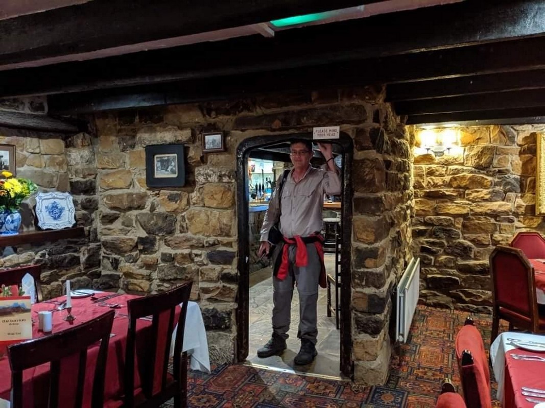
However the early finish meant we were able to settle in to the brilliant Lion Inn (yes the naming theme continues). Dating back to the 16th century, it assumes a lonely position atop the Moors and adjacent to a road. I read somewhere that it is England’s 4th most elevated Inn, which is funny when you realize its only 400m above sea level. We have arrived on a Saturday and it was packed to the rafters – and I mean this literally, as with nearly all the old buildings in England, the ceiling and doorways are very low – one nearly needs a helmet, especially after a few beers.
Day 16 – The cold wind from the previous day has persisted, accompanied in parts with light rain in the afternoon and virtually no sun. Again a short day of 5 hours easy walking across the Moors down to the village of Glaisdale. Crossing the Moors today, we saw and heard many of the Grouse that inhabit the heather – they are quite cute and very funny with the noises they make.
Another pub stay and another English sized serving of dinner. I can only think the cooks in England assume everyone is starving with the huge servings we have been consistently receiving.
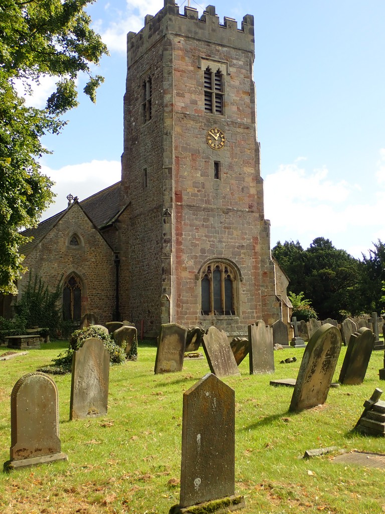
Day 17 – Leaving Glaisdale we stop at the nearby 400 year old Beggars Bridge. The weather is perfect walking alongside the river to the beautiful village of Egton Bridge, home also to the impressive St Helens Church, where we took the opportunity for a quick look inside.
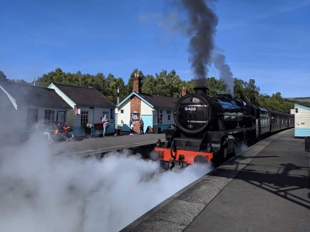
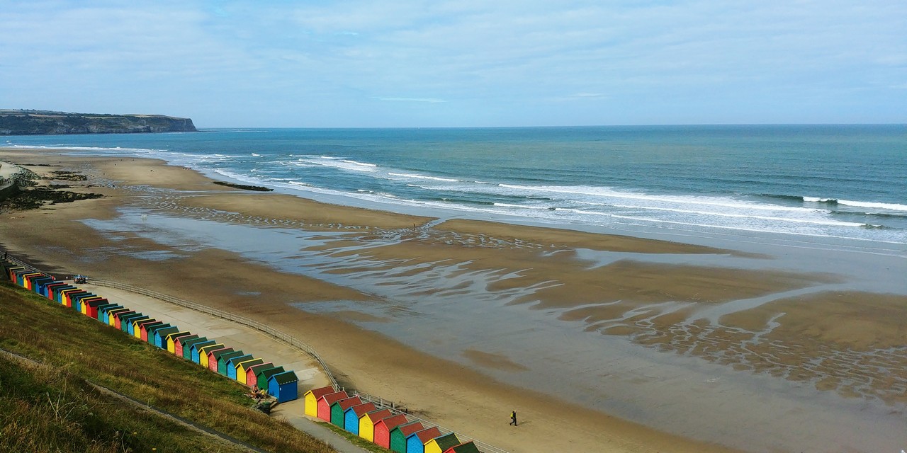
A short walk into the village of Grosmont, where Elena has arranged for us to catch a steam train (featured as the ‘Hogwarts Express’ in the Harry Potter film) to the nearby seaside tourist hub of Whitby. The 2 hours we had between trains in Whitby did not do it justice, and fortunately we were able to return to Whitby a couple of days later (after completing the C2C) for a more thorough exploration.
Before leaving Grosmont, a walk through what is thought to be the worlds oldest passenger railway tunnel is a worthy visit. The trail out of town is quite a shock, particularly after the last couple of days of easy strolling, with a very steep climb up to Sleights Moor. The views of the North Sea are now much more frequent as we walk down to the village of Littlebeck and then a sidetrip out of town to a working farm and our last night on the C2C. Surrounded by sheep and cattle, the farmhouse is a great unwind after a long walk.
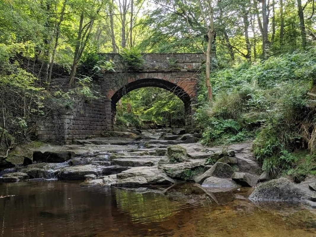
Day 18 – Returning to the tiny village of Littlebeck from the farm, our day starts with a brilliant walk through Littlebeck Wood alongside the river and waterfalls. Exiting the Wood, we work our across our last Moor of the walk again exposed to the cold wind, but tempered with the constant views of Whitby and the North Sea.
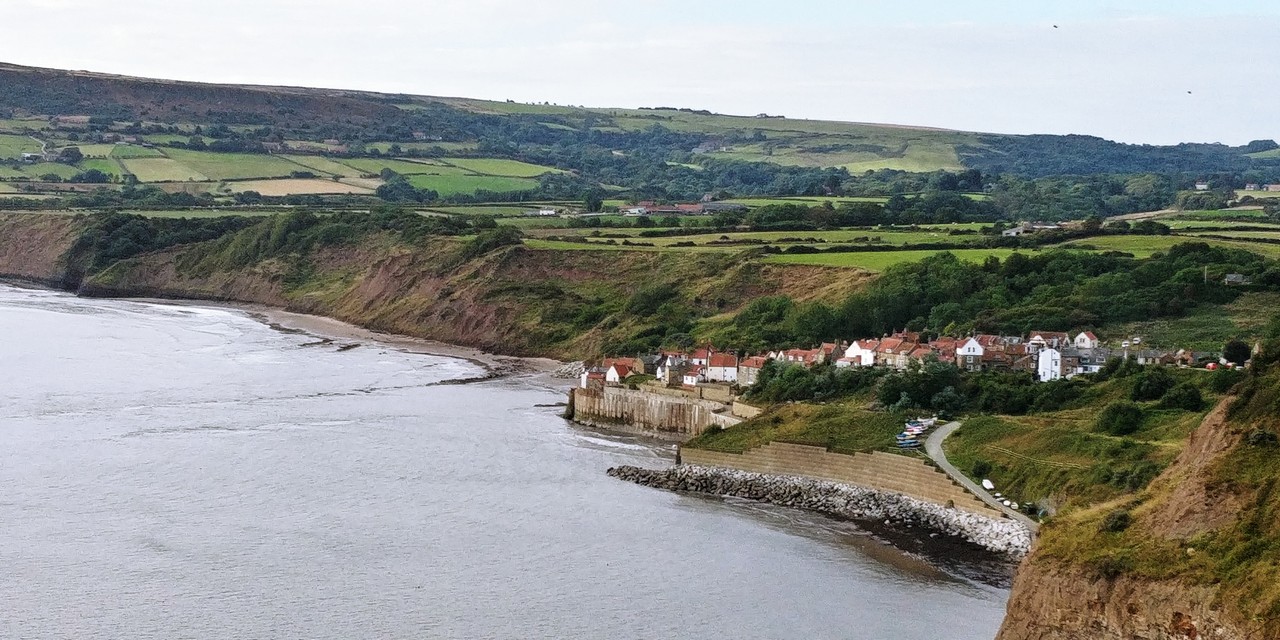
Finally we arrive atop the steep cliff faces high above the breaking waves of the North Sea, halfway between Whitby and Robin Hood Bay.
This definitely and finally felt ‘right’, and after finding a little hidden spot slightly off the trail with a view back along the cliffs, I finally took action on what has been consuming me for the entirety of the C2C. And with only the seals swimming below as my witness, I proposed to Elena….and she said yes!

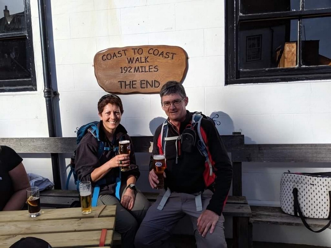
The final section along the clifftops in brilliant sunshine felt perfect, before we walked somewhat victoriously into Robin Hood’s Bay. Walking through the town and down the narrow main street that dropped steeply to the boat ramp, we again wet our feet and tossed our pebble into the North Sea to celebrate what has been a very special day….and incredible journey across the breadth of England.
For more photos:
https://www.flickr.com/photos/danthewanderer/albums
THANK YOU FOR READING. COULD I ASK A FAVOUR? If you found this story interesting or useful enough for others to see, please share our love of the great outdoors and this beautiful planet via your social media - it all helps: